My research visit to the Universitat Autònoma de Barcelona (UAB), Spain, during October 10–25, 2024, funded by the Tampere Urban Research Network for Sustainability (TURNS), focused on investigating new synergies between Tampere University (TAU) and UAB in research fields related to sustainability, security, GNSS, and urban planning.

The first meeting of the research visit was with Dr. Konstantinos Kourkoutas, the coordinator of the CORE initiative at UAB. CORE, “Ciutats Intel·ligents i Sostenibles – Xarxa de Recerca” (in English, “Research Network on Sustainable and Smart Cities”), is an initiative for smart and sustainable cities, where different research groups, departments, centres, and campus infrastructures develop their joint capacities to create new multidisciplinary research activities. CORE is also tightly connected to the LET Metropolitan Laboratory of Ecology and Territory of Barcelona, which aims to assist in creating new standards, ideas, maps, databases, models, and indicators for analysing the metropolitan system’s functionality from a socio-ecological viewpoint, with the goal of shaping public policies and land use planning. The initiative can facilitate connection with a wide range of stakeholders in the field of urban sustainability for any future TAU-UAB collaborations in CORE-related fields.
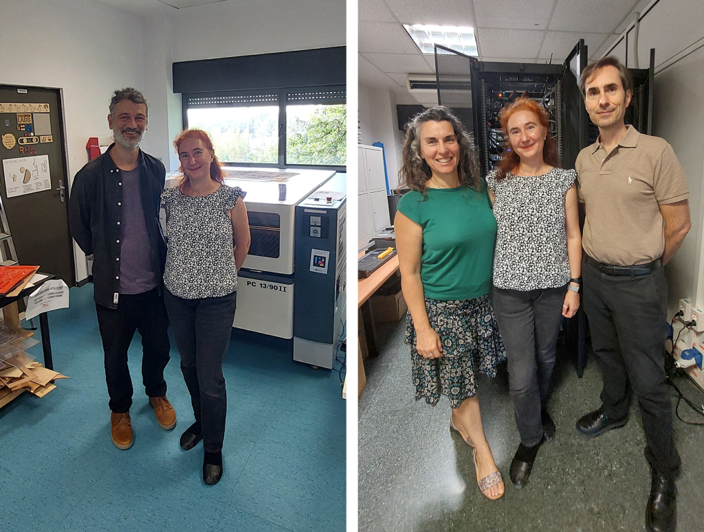
(2) In the server room of the SeNDA group, with Dr. Maria Carmen de Torro Valvidia and Prof. Sergi Robles Martínez.
Another research meeting was held with the team of the Security of Networks and Distributed Applications (SeNDA) group from the Department of Information and Communications Engineering at UAB, led by Prof. Sergi Robles Martínez. The SeNDA group focuses on several key areas, including security in networks, distributed systems, and applications, particularly in the context of delay and disruption-tolerant networking (DTN) and opportunistic networks. The group has been developing models and algorithms to improve communication in opportunistic networks, which can be crucial for urban environments where traditional network infrastructure might be lacking or overloaded. They have also created secure communication protocols for mobile crowd sensing and other applications, enhancing data privacy and security in urban settings. Their work on efficient broadcast methods and message delivery in social opportunistic networks can also help in managing urban data traffic more effectively. A synergistic feature with TAU research is in the field of wireless secure connectivity: by improving communication in opportunistic networks, one can enhance the security and connectivity in urban areas, which is essential for smart city applications.
The research visit continued with a presentation and discussions with the team of the Research Group in Mobility, Transport, and Territory (GEMOTT) in the Department of Geography at UAB. The team is led by Prof. Carme Miralles Guasch, Professor of Urban Geography. I had the pleasure to meet and discuss with two postdoctoral researchers in her team, Dr. Monika Maciejewska and Dr. Oriol Marquet, as well as with the team of about 10 PhD students conducting research at GEMOTT.
The GEMOTT team has been involved in several impactful research projects, particularly focusing on urban sustainability and mobility. Their research on the “Superblock Effect” has shown that areas with superblocks in Barcelona exhibit stronger electoral support for the incumbent party, Barcelona en Comú (BEC), despite a general decline in the party’s popularity citywide. This indicates that urban design interventions such as superblocks can have significant political and social impacts. The GEMOTT team has also explored the concept of 15-minute cities, which aim to ensure that residents can access most of their daily needs within a 15-minute walk or bike ride. Their findings suggest that proximity to amenities generally increases rental prices, highlighting the need for balanced urban planning to maintain affordability. Their studies on mobility have revealed significant differences in transport mode choices between different population groups, such as students and workers, and between genders. This research helps in understanding the diverse needs of urban populations and planning more inclusive transport systems.
We are currently planning to start a TAU-GEMOTT collaboration in the field of youth mobility and youth views for a sustainable, equitable, and resilient future within various ECIU funding paths. Better insights into transport preferences and behaviours can guide the creation of more efficient and equitable mobility systems, reducing reliance on motorized transport and promoting sustainable alternatives. Our TAU research on GNSS-based analysis and classifiers can play an important role in identifying mobility patterns, optimizing urban routes, and better analysing multi-modal transportation.
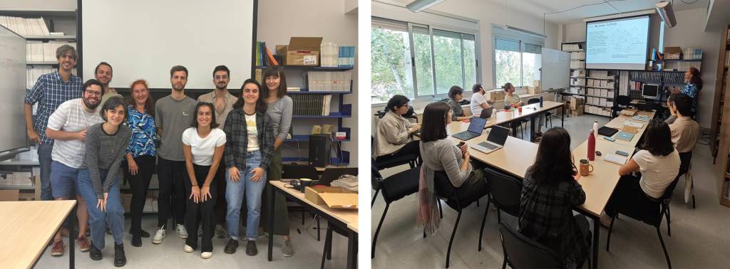
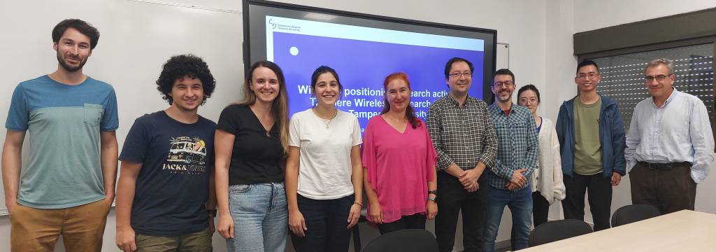
Finally, I presented our current main projects and research work to the Signal Processing for Communications and Navigation (SPCOMNAV) team from the Department of Telecommunications and Systems Engineering at UAB. Prof. Gonzalo Seco-Granados and Prof. José López-Salcedo lead the SPCOMNAV research group that is working on various projects related to, e.g., outdoor and cellular localization, GNSS, LEO-PNT, 5G/6G positioning, and spoofing and jamming mitigation. Their team has made significant contributions in the fields of signal processing, communications, and navigation, particularly focusing on satellite-based positioning and integrated sensing and communication systems.
SPCOMNAV’s research areas align closely with the research fields of my team on signal processing for wireless positioning (TLTPOS) at Tampere University. UAB SPCOMNAV and TAU TLTPOS groups are currently part of the European MSCA Training Network on “ultra-massive MIMO for future cell-free heterogeneous networks” (MiFuture). Our common research interests, such as satellite-based positioning, 5G/6G cellular-based positioning, and Joint Sensing, Positioning, and Communications (JSPAC), are important in the context of both low-cost and high-precision location services in urban environments. By improving the accuracy of positioning systems, our mutual research supports the development of smarter transportation networks, which can reduce traffic congestion and lower emissions.
Additionally, integrating sensing and communication technologies can lead to more responsive and adaptive urban systems, such as real-time monitoring of environmental conditions and infrastructure health. Solutions to mitigate GNSS signal spoofing and interference also ensure that critical urban services, such as emergency responders and autonomous vehicles, operate reliably and securely. In summary, there is significant potential in the areas of wireless positioning and JSPAC to contribute to creating more efficient, safe, and sustainable urban environments, and we plan to harness this potential in future collaborative research and joint project applications.

(2) The opening of the UAB university year on October 15, 2024.
(3) Student event on the campus: “Castellers”, human tower.
E. S. Lohan is a professor in wireless positioning field at Tampere University and the leader of TLTPOS research group on Signal processing for wireless positioning at Tampere Wireless Research Centre. She is a co-editor of the first book on Galileo satellite system (Springer “Galileo Positioning technology”), co-editor of a book on “Multi-technology positioning”, and author or co-author in more than 300 international peer-reviewed publications. She was the Coordinator of the MSCA European Joint Doctorate project A-WEAR, www.a-wear.eu, in which all 15 PhD students would have completed their double PhD degrees by 4th of Dec 2024. She is now involved as scientist in charge in two MSCA ITNs at TAU, APROPOS and MiFuture and is the principal investigator of a transnational EU-RCF LEAP-RE project, LEDSOL related to universal potable-water access and water disinfection in Africa. Her research interests are related to GNSS, indoor and 5G/6G-based positioning, tracking and navigation for intelligent and automated machines, RF fingerprinting and interference mitigation and management in wireless navigation receivers, LEO-based navigation solutions, urban sustainability, integrated sensing and communications, and simultaneous localization and mapping.

