

In historical research, maps have always been used extensively both as primary sources and as tools for illustration. Spatial data is particularly important when other sources, such as documents, are scarce. New spatial information about the past is constantly produced.
In the 2010s, historians began to digitize and publish spatial data from the medieval and early modern world. This has resulted in easy-to-use maps that allow one to study old routes and search for them in familiar local environments – also in Tampere and Pirkanmaa.
Viabundus map is an easy interface to old data
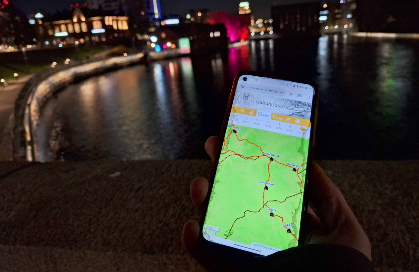
The project Viabundus Suomi 1350–1650 compiles spatial information about Finland’s late medieval and early modern traffic routes into a database. The result is a digital Viabundus map that anyone can use.
The results of the three-year Finnish project, including the spatial database and map interface, was published in May 2025. The Finnish Viabundus project was led by docent Tapio Salminen, who has extensively researched the road history in Finland and the Northern Baltic Sea region.
– We collect not only maps but also information from written sources. Converting written information into spatial data is something new in the Viabundus project. The information could be national in scope and therefore difficult to use locally, or, on the other hand, the map information might be only local without broader connections to other regions, Salminen says.
Viabundus map from Central Europe has already been used, for example, in museum pedagogy. In museums, the Viabundus map has served as a digital layer illustrating the history of movement, for instance in the Netherlands.
– Writers have used the Viabundus map to help with historical fiction. In the academic world, I have encountered Viabundus at a history conference, where a researcher used the database to illustrate their research subject’s route and travel times, says Jenni Lares.
Jenni Lares is one of the researchers in the Viabundus Suomi 1350–1650 project. She has examined information from old maps and written sources, classified it, and created a database of the points of service, like taverns and inns, along the medieval and early modern roads.
Lares, who also practices historical reenactment, believes that the Viabundus map is a useful tool for history enthusiasts. Pilgrims, hobby-walkers of old routes, LARPers, and game designers can all benefit from the Viabundus map.
– Digital tools are constantly developing, and even artificial intelligence can be useful when creating virtual representations of history. In Finland, genealogists have a very high level of digital skills, and Viabundus may also be very useful for them, says Tapio Salminen.
The Viabundus map is based on strong historical source material
At its core, the Viabundus map is based on traditional historical sources: bailiff’s records (fi. voudintilit, sw. fogderäkenskaper), and provincial records (fi. läänitilit, sw. länsräkenskaper), which contain information about road building and maintenance as well as inns.
– We also use court records, and some sources that are already used in local history studies. We use maps from the 17th century onwards as well as modern road inventories and studies done by various authorities and museums, Lares and Salminen explain.
In Finland, much research has been done on road history. Thanks to the strong academic background, it was possible to begin creating the Viabundus map, without having to research the roads themselves first, Lares and Salminen say.
The Viabundus project is international, just as the roads were and are. Before Finland joined the project, Viabundus map covered parts of Germany, Netherlands, Denmark, and the Baltics. The first Viabundus map, published in 2021, was based on Hansische Handelsstraßen, the Hanseatic Road atlas published in the 1960s. After the initial publication, the map has been expanded in national and provincial research projects.
The Hanseatic atlas reached to Viipuri but did not cover Scandinavia. With the Finnish subproject, the Viabundus database has now expanded northward. Sweden has also started their own Viabundus project.
In Finland, much research has been done on road history. Thanks to the strong academic background, it was possible to begin creating the Viabundus map, without having to research the roads themselves first, Lares and Salminen say.
Inn records reveal the history of travel
Administrative material has survived from early modern inns and taverns. The buildings also served as boundary markers, so sometimes their location is known. Many things happened at these inns, too, and these often criminal activities were written to legal sources which have been preserved to our times.
Jenni Lares has researched early modern alcohol use in her doctoral dissertation, and in that context, she has studied also drinking establishments such as inns. Interpreting spatial data on inns from written information is a task requiring the historian’s interpretive skill, critical understanding, and deep knowledge. Inns were important in travel, and therefore their locations are a key part of the Viabundus map.
Creating historical spatial data on the early modern period is slow and laborious. When a peasant was granted the rights for running an inn in, say, 1634 in the village of Karvala, that inn might later appear under a different name in later maps. It requires long detective work and familiarity with sources and historical sites to place the inn correctly on the map.
Creating historical spatial data on the early modern period is slow and laborious. When a peasant was granted the rights for running an inn in, say, 1634 in the village of Karvala, that inn might later appear under a different name in later maps. It requires long detective work and familiarity with sources and historical sites to place the inn correctly on the map.
– Have the village or farms changed location, do later maps reliably reflect old road alignments, or have they changed? When does a crossroads become important, and when does its use cease? These questions can be answered, and often road alignments and village sites have stayed in the same place, but each piece of information must be considered independently, Lares explains.
Even a historian’s data contains uncertainties, but a unified presentation can still be reliable and contain new information. One must be precise and tolerate laborious work.
– By combining information from different sources and research literature into spatial form, one may discover new road alignments and travel routes, and thus better understand the people of the past and their actions, Lares says.
Lares has compared and pondered the mysteries of lakes and villages with the same names, such as Kirkkojärvi. There are many Kirkkojärvi lakes in Finland because people traveled to church by water, and the lakes were named locally. Topography, natural conditions, and the everyday life of early modern society were reflected in place names. In western Finland, Taipale names often refer to winter roads; in the east, they refer to taivaltaminen, meaning hauling boats over isthmuses, Salminen explains.
– As sources, we have used, among others, King Gustav Vasa’s scribe Jaakko Teitti’s list of Finland’s public roads from 1555, when Teitti surveyed noble landholdings and taxation conditions in Finland, and the lodging register of Gustav Vasa’s son, later King John III, who served as Duke of Finland from 1556–1563. The register lists places where Duke John lodged during his inspection journey of ducal estates. These administrative documents list manor houses, lodging sites, and distances between them, Lares says.
The establishment of inns took place on the initiative of the administration, and they had state-level significance. Inns were as essential a part of long-distance travel as the road itself, because services were provided at inns, and one could not travel hundreds of kilometers without such support. Inns (fi. kestikievari, sw. gästgivare) and alehouses (fi. krouvi, sw. krog) existed separately, but the latter did not have an official role in the travel system, since transport was organized via official inns. There are, however, many houses named Krouvi from the medieval period, and their main function was to sell food and drinks to travellers.
– Inns and alehouses remain unchanged for long periods in some places, Lares says.
One source for the Viabundus map is the Suomen kylät 1540–1940 spatial dataset. It is an open dataset published by the National Archives, mapping all of Finland’s old villages. The dataset also includes other information about villages, such as the founding year or first mention, other names of the village, and the administrative parish to which it belonged.
– The locations of these villages were used as the basis for the Viabundus map, because usually we know only in which village an inn was located, not the exact farm, Lares says.
There was an inn even in central Tampere
Jenni Lares says that there was very likely an inn in the center of Tampere.
– The plot of the Tammerkoski village was roughly located where Laikku and Kirjastonpuisto are today. The Pirkkala local official, parish constable (fi. nimismies, sw. länsman) lived there already in the 1530s, Lares says.
The city of Tampere was founded only in 1779. In the 1500s, the area of the present city belonged to the parishes of Messukylä and Pirkkala.
– The Tammerkoski village at today’s Kirjastonpuisto belonged to Pirkkala, and in the 1500s and early 1600s, the Pirkkala parish constable’s house was located there, Lares explains.
In 1556, Duke John of Finland spent the night in Tammerkoski on his journey from Kokemäki to Hämeenlinna, probably in the Pirkkala constable’s house on the west bank of the rapids.
– In the late 1500s, the parish constable of Pirkkala was Juhani Erkinpoika Vaininen. In the 1500s, parish constables were obligated to maintain an inn, so one likely existed near the rapids by the bridge. Vaininen is listed as an innkeeper in the 1639–1640 inn register, even though from 1622 to 1644 the constable’s house and inn were in Nalkala, on the border of present-day Kaakinmaa and Pyynikinrinne, Lares explains.
Toijala was also an important transportation hub in the Middle Ages: two summer roads and a winter road to Turku intersected there.
– One of the houses in Toijala received its name from an inn. In 1561, the tax register mentions Jussi Sipinpoika Koiweri and in 1575–1578 the brothers Jussi and Heikki Sipinpoika Köyväri. Koiweri and Köyväri refer to kievari, an inn. In Toijala, the street Köyvärintie – the inn road – still exists, Lares says.
Established waypoints were an important part of the road network
The road network needed a support system because travelling was slower than on modern days. The Viabundus map marks, in addition to inns, various established waypoints (etapit), which in the English version are labeled node. They are “structures supporting roads,” meaning places that supported travel and transport. various other kinds of permanent or semi-permanent waypoints and stopovers.
– The established waypoints included places with town privileges, lodging near monasteries, inns, staples tapulipaikat that were locations where a merchant had to unload goods and offer them for sale, villages, crossroads, and marketplaces. Places that supported transport and travel, Salminen says.
Churches, marketplaces, and villages emerged along routes, in traffic hubs. A medieval traffic hub is an intersection of multiple roads, or the junction of a winter and summer road, or the crossing of water and land routes. Hyhky, west of Pispala in Tampere, is a good example of such a hub.
Near Hyhky, at Kaarila, the Gadd Chapel stands at the site of the Harju marketplace, which operated from 1602–1638 and 1708–1750. The Gadd Chapel is the second-oldest building in Tampere. The marketplace was located near the church and cemetery built in 1639 and demolished in 1858, in the area where the chapel stands today. From 1638 to 1708, the market was held in Tammerkoski.
– Hyhky has been at the junction of summer and winter routes since the Iron Age. It appears to have been an old market and the site for the sessions of the parish court. The chapel was built in Harju because of the crossroads, not the other way around, Salminen says.
– Hyhky has been at the junction of summer and winter routes since the Iron Age. It appears to have been an old market and the site for the sessions of the parish court. The chapel was built in Harju because of the crossroads, not the other way around, Salminen says.
Established waypoints along public roads offered travelers shelter; the inn system provided food and the possibility to eat and change horses. They were crucial for long-distance travel before the development of modern transport.
Even on the Viabundus map, various kinds of waypoints generally appear about one day’s walking distance apart. The law also required inns to be 20–30 km apart. This was a day’s walk that could be repeated the next day. Tapio Salminen has himself tested early modern day-walk distances: from Tampere to Nokia to Siuro, and from Kangasala to the Kaivanto Canal.
– When we practiced this, we heard comments that of course one can walk fifty kilometers in a day. Well, yes, but try walking the same distance the next day!
Weather, wars, and local economic conditions affected travel. A bridge might have collapsed or burned, a road might be muddy and slow, or an epidemic might have wiped out intermediate stops.
Travel equipment and seasonal routes had a major impact on travel times. In late medieval and early modern Finland, daily distances were 20–40 km on foot, slightly longer on skis, 50–60 km on horseback, and in winter 70–90 km by sleigh if horses were changed several times. Ninety kilometers was an absolute maximum. On the Viabundus map, one can estimate travel times.
In winter, more goods could be carried on a sleigh. Weather conditions, the demands of local subsistence economies, and agricultural cycles dictated the timing and conditions of travel.
In winter, more goods could be carried on a sleigh. Weather conditions, the demands of local subsistence economies, and agricultural cycles dictated the timing and conditions of travel.
– Taxes were paid in winter because the harvest was done and there were no other urgent tasks. One had the means to pay taxes, it was easier to transport goods and foodstuffs in which taxes were paid, and there was time to make the tax-paying journey, Salminen says.
Delivering taxes—that is, the tax-paying journey—was a major part of the tax burden, because transportation took much valuable time. Tax transport was usually done collaboratively by the village’s men, in long convoys.
– The reason for traveling together was sociability, ease, community, and help if a horse broke its leg. Traveling together was safer due to robbers and wild animals, and if everyone did not know the route, others could help, Salminen and Lares explain.
Almost everyone traveled at some point
Everyone had the plight to attend a mass in the parish church at least once a year: even the poorest, small children, and people with disabilities. Going to church was a social event. Almost everyone moved somewhere during their lifetime, at least within the local area.
Peasant men traveled more than women, and men made longer journeys more often. All officials in the premodern period were men, and men took care of the tax trips. Peasant women moved more inside the parishes, but members of the parish elites of both sexes often entertained trips to neighboring areas and towns.
Peasant men traveled more than women, and men made longer journeys more often. All officials in the premodern period were men, and men took care of the tax trips. Peasant women moved more inside the parishes, but members of the parish elites of both sexes often entertained trips to neighboring areas and towns.
– Sometimes officials and merchants might have their wife with them. Some, for example merchants’ widows, took over the business after the husband’s death and managed the inherited property and their children’s matters. Widows moved the most among women, Jenni Lares says.
Soldiers also moved around, and various camp followers traveled with them, including women. During Sweden’s Great Power era in the 1600s, supraregional mobility increased because of the wars.
People from the Tampere region also went to Sweden and Livonia (present Estonia and Latvia) for work. According to Salminen many young women from the Southern Finnish province of Uusimaa moved to Reval (Tallinn) to work already in the Late Middle Ages.
– It is a phenomenon that crosses time periods that people move to bigger cities to look for work, Lares says.
The seasons and the terrain determined where the roads went
The seasons affected not only the means of travel but also the routes. Winter roads were in use for four to six months. They followed meadows and field clearings, swamps, lakes, and riverbanks, forming a different network compared to summer roads, footpaths, river and stream crossing points, or water routes.
Summer and winter roads were separate, although they ran close to each other and often intersected. Water routes were also important both when open and when frozen.
– The reason for moving determined the time of travel. Often the regional destinations between which people moved are the same, Salminen says.
For example, in Ostrobothnia you can see that the winter road went via Kyrönkangas and the summer road via Jalasjärvi. From Hämeenkyrö a summer road went via Jämijärvi and Karvia to Kauhajoki, and the winter road via Parkano and Jalasjärvi to Kurikka, and both connected Upper Satakunta to Ostrobothnia.
Waterways have been important across Scandinavia. In Norway, the role of roads appears to have been s smaller because it was difficult to build and maintain roads due to mountains and fjords, which themselves functioned as water routes. In the archipelagic Denmark there has been ferry traffic already since the 1100s.
The idea of water routes as the unifier of the Finnish people is a national romantic idea
In Finland, water routes connected parishes and people locally, but the idea that water routes connected the Finnish people across the entire area of Finland is a later national romantic idea, Lares and Salminen say.
Water routes were important, but they were especially important in the lake regions of Inner Finland. Elsewhere in Finland the water routes were local, and they did not connect large areas.
– In Inner Finland water routes were more important than in the permanently cultivated Southern Finland since the Iron Age because there were more water routes and they tied together pockets of settlement both in summer and winter. The main roads that run from Inner Finland, that is from Tampere, Jämsä, Sysmä, Mikkeli and Savonlinna northwards, were built mostly only in the latter half of the 1600s and during the 1700s, Salminen says.
The network of medieval common roads ran through Tampere but it extended into the Näsijärvi region north of Tampere only during the 1600s, when the former wilderness areas were settled starting from the 1550s.
The network of medieval common roads ran through Tampere but it extended into the Näsijärvi region north of Tampere only during the 1600s, when the former wilderness areas were settled starting from the 1550s. Pyhäjärvi and the Vanajavesi water system, however, formed an important basis for the winter road network until the 1800s.
Pyhäjärvi was an important route in the Tampere region because it connected the areas of present Tampere, Vesilahti, and Pirkkala. The old villages of Narva and Laukko in Vesilahti are on the lake shore, and water connected them to the Tampere and Lempäälä area.
When looking at the Viabundus map, water systems explain why many locations that were important in the premodern period appear remote today. Old villages are in reasonable places when their location is explained by water routes and winter roads. For modern people water bodies are mostly obstacles to be bypassed: From Lempäälä’s Ania to Vesilahti’s Narva and Laukko is a long distance, and modern traveler might wonder, why they have been in such a close contact.
Traveling was a slow event
As with road conditions, the alternation of light and darkness and the soundscape of nature affected the experience of traveling, Lares and Salminen say. One could travel a lot after sunset if one wanted to travel efficiently in winter.
In winter half of the trip was done in darkness or in moonlight if one drove a proper 50–60 km freight day’s journey. In winter, the snow and moonlight illuminated the route effectively. In early spring one could travel by sled and the days were long, so it was a good time for transportation. Sleigh bells and sounds meant to scare animals were a part of the ssoundscape of travelling.
Medieval and early modern people did not set off with the Viabundus map in their pocket. Maps were expensive and rare, and they were not mass-produced. Some travelers knew the road because they used it regularly and became familiar with it.
Medieval and early modern people did not set off with the Viabundus map in their pocket. Maps were expensive and rare, and they were not mass-produced. Some travelers knew the road because they used it regularly and became familiar with it. Local hubs and inns were also places where one could get information on how to travel to the next established waypoint or hire a guide, usually a young boy (fi. kyytipoika), who knew the way.
– When you traveled as a child with the men of the family to Turku market, you learned the route and could pass on the knowledge to your own descendants, says Lares.
Officials traveled to carry out tasks, and there was no fixed legal office or tax office where matters were handled. Court touring routes are relatively easy to reconstruct afterwards because there are surviving sources. Priests also traveled on various errands, and this has left behind records of their travel routes.
– Within parishes and between neighboring parishes ordinary people traveled to churches, courts, and to visit relatives, and marketplaces could be farther away, Salminen says.
In the Middle Ages pilgrims also traveled, including peasants. Young people left to work in neighboring parishes, large cities, and abroad, to Stockholm, Reval (Tallinn), and Riga.
Traveling was laborious, dangerous, and slow from a modern perspective.
Traveling was laborious, dangerous, and slow from a modern perspective.
– Slow travel was part of everyday life for people in the past, and mobility also involved sociability. The image of the premodern era and the past is very tied to staying put, and we think that only progress and leisure have brought the possibility to move, but this is not the case, Salminen says.
According to Salminen, it must be remembered that people of the premodern era were in general more aware of their geographical surroundings than is assumed. Probably more aware than many modern people who travel by car and use Google Maps.
– That knowledge was not information conceptualized through a map image, but horizontal knowledge related to perceiving distances and the time consumed, Salminen says.
Quarreling over road maintenance produced a lot of source material for historians
From the 1340s onward, it was decreed in the common law that the public roads were to be maintained as a tax duty, i.e. road building and maintenance was the responsibility of the province’s tax-paying peasants. The Finnish word maantie means provincial road, i.e a road maintained by the taxpaying peasants of the whole land (maa, province), not “a road on land”
The 1347 land law of Magnus Eriksson decreed that there must be a common road from and to every village. A common road meant already in the Middle Ages that the life and property of every traveler was protected by the king.
From the 1300s onward the central authority divided routes into two groups: the common roads maintained by peasants, which connected provinces, parishes, and administrative centers, and other routes outside of official legislation.
– Twice a year, usually in spring before the sowing and in autumn after the harvest, was the time when the peasants had to go maintain their section of road. The practical work was done by the farmstead, including farmhands. Bridges were renewed as contracted work. Larger bridges were maintained by the province or district, and they were renewed every 30–40 years. Peasants supplied the materials. Even at the end of the Iron Age there were certainly road arrangements among communities, Salminen says.
Old road sites are still visible in light traffic routes
Road history is layered because road alignments are on narrow areas and therefore often run close to each other and overlap, even when a new road is built.
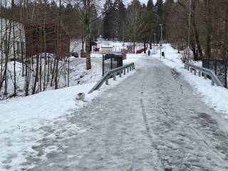
Many old road alignments have survived as bicycle and pedestrian paths. They remained in use until the 1920s and 1930s or even the 1960s, Salminen says. Until then they served as highways, and embankments remained there, which were used when building new light traffic routes. Bridges and bridge sites were already in place. One such bridge site is, for example, in Kaukajärvi in Tampere.
Road ruins can still be found in the terrain. One learns to notice them, Salminen says.
– They are, for example, bends that remained in their 1930s–1950s form when the road was later straightened as road construction technology made large scale blasting rocks possible.
AI has been used in translating this article. All facts and historical terms have been checked by the author, Jenni Lares and Tapio Salminen.